By RYAN MORSE
WISH-TV | wishtv.com
Central Indiana typically has a few “wind chill warnings” or “wind chill advisories” in a given winter.
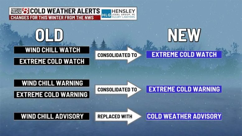
Those terms, however, will no longer be issued as the National Weather Service (NWS) makes changes to its cold weather alerts for this upcoming winter.
The goal of the changes is to clarify that cold can be dangerous with or without wind.
A wind chill watch has been consolidated with an extreme cold watch to become an extreme cold watch. Wind chill advisories have been replaced altogether with cold weather advisories. Finally, the wind chill warning and extreme cold warning have been merged into an extreme cold warning.
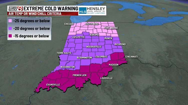
Extreme cold warnings are issued when dangerously cold air with or without wind is expected. In Indiana, the threshold is different because we have multiple NWS offices that cover the state. For central Indiana, an air temperature or wind chill of -20 degrees will trigger this type of warning.

Graphic provided by WISH-TV
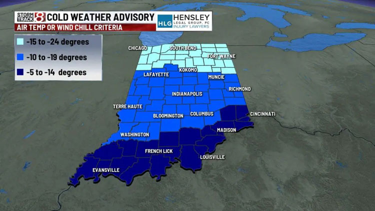
Cold weather advisories are less severe than extreme cold warnings. Wind chill values of air temperatures in the range of -10 degrees to -19 degrees will prompt these advisories in central Indiana.

Graphic provided by WISH-TV
Extreme cold watches will be used when cold air with or without wind is possible. When these are issued, be sure to follow the forecast closely in the coming days. This type of cold alert would be issued prior to an extreme cold warning or a cold weather advisory.
You can always follow the latest seven-day forecast by visiting the Storm Track 8 weather blog.
This story was originally published by WISH-TV at wishtv.com/weather/weather-stories/national-weather-service-makes-changes-to-its-cold-weather-alerts.

