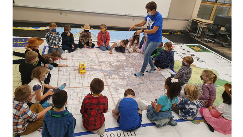
Despite the world seeming a little smaller due to this season of social distancing, students at Hamilton Heights Elementary School (HHES) enjoyed the opportunity to go around the world through an interactive geography enrichment lesson to supplement their classroom studies.
The maps were the centerpiece of the entertaining and educationally powerful lesson for students to engage in a close look at cities, countries, historical, geographical, and cultural points of interest.
Melissa Martin, HHSC Technology Integration Specialist, who shares a love of history and geography, worked together with classroom teachers to bring this activity to life for students.

Photo provided
“We read books about maps to learn the basics, but Mrs. Martin helps the map skills come to life,” explained Jennifer Tebbe, HHES first-grade teacher. “Students are able to walk and crawl around on REAL maps to discover things like land vs. water, what different symbols mean, and where they are on each map. The students LOVE this experience! It is like having a field trip, but we get to stay right at school.”
“This was a great hands-on learning experience led by Mrs. Martin,” added Ashley Mandary, HHES first-grade teacher.
“This is a really fun program to lead,” said Martin, who has been taking these maps into Heights’ classrooms for about a decade. “These giant maps help us work in interactive lessons on the power of maps and geography at the same time. Students hop around to the different countries and states, spend time learning about different areas, identify well-known landmarks as well as go through activities to help with basic map reading skills.”

